What Brokers Need to Know About Access, Boundaries, and Property Taxes
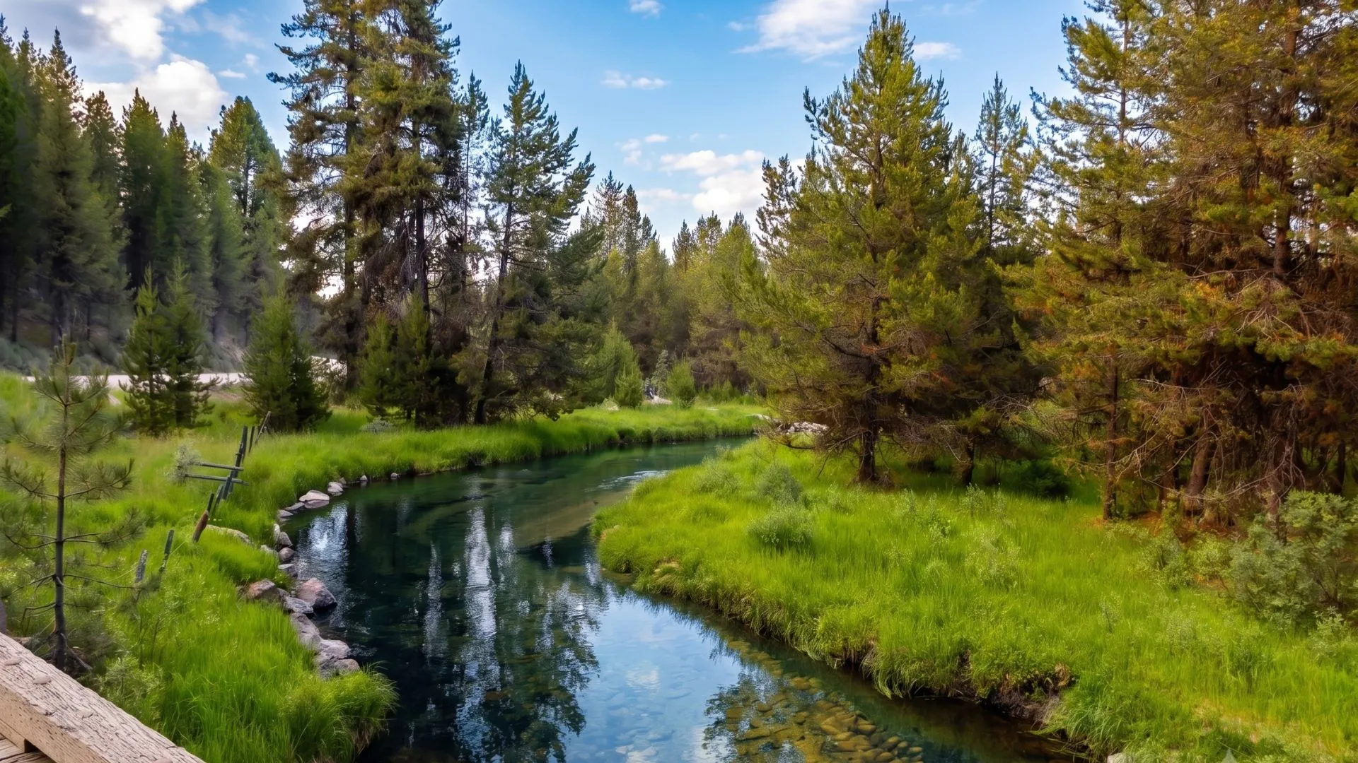
A listing’s photos show a fence line dissolving into open timber, and buyers assume that view comes with unrestricted access to hunt, ride, or eventually build a road into the forest beyond it. That’s not how it works, and the sooner a buyer understands the real rules, the smoother the transaction goes.
Owning property next to national forest land doesn’t come with an automatic right to cross it, build a road across it, or otherwise develop it. Any access across U.S. Forest Service land needs its own authorization, separate from the private property sale itself. Brokers who understand this early can set realistic expectations with buyers and keep a deal from falling apart at closing over an assumption that was never true.
Table of Contents
What Does It Mean When Property Borders National Forest Land?
A property that borders national forest land simply means the private parcel’s boundary line meets ground managed by the U.S. Forest Service as part of the National Forest System (NFS). That’s a fact about geography, not a grant of access or development rights on the public side of the line.
Buyers can generally hike, hunt with the appropriate state license, and recreate on that land like any other member of the public, subject to Idaho Department of Fish and Game regulations and local forest rules. Owning the adjacent parcel doesn’t give them any special right to build a driveway, run utilities, or otherwise develop across it.
How Does Access Across National Forest Land Work?
If a buyer’s only reasonable route in or out of a property crosses land inside the National Forest System, they’ll need what the Forest Service calls a special-use authorization, a category that covers permits, term permits, leases, and easements for a specific use over a specific period. According to the U.S. Forest Service’s own guidance on applying for a special-use permit, the process starts with a required pre-application meeting at the local Forest Service office, where staff walks through the proposal, potential conflicts, timelines, fees, and any environmental review that might be needed.
A few things brokers should flag for clients early:
- Applicants must show that the proposed use can’t reasonably go on non-federal land instead. Lower cost or convenience isn’t a good enough reason to use NFS land.
- The application requires a detailed project description, a map showing the requested use in relation to Forest Service land, and proof the applicant can build, maintain, and eventually remove the improvement.
- Costs include both cost recovery fees, which cover the agency’s processing time, and land use fees, an annual rental based on fair market value.
- None of this moves fast. Pre-application meetings, environmental review, and public comment periods make this a planning consideration rather than a closing-week formality.
A buyer counting on that access to build right away needs this timeline in the conversation well before an offer gets written.
Why Do Boundary Lines and Encroachment Matter More Near National Forest Land?
Every land purchase benefits from a current boundary survey, but it matters even more next to national forest land, because there’s no neighbor across the fence to work out an informal fix with if the boundary turns out to be different from what everyone assumed. A survey done before closing can catch a fence line, road, or structure sitting across the actual property line, giving the buyer a chance to resolve it through a written agreement, an easement, or a boundary line adjustment instead of finding out after the sale closes.
Specifically for national forest land, an outdated or missing survey poses another risk: a buyer who unintentionally builds or clears on Forest Service ground, which turns a simple boundary question into a federal enforcement matter rather than a dispute between two private owners.
What Is Payment in Lieu of Taxes, and Why Isn't Idaho's Land on the Tax Roll?
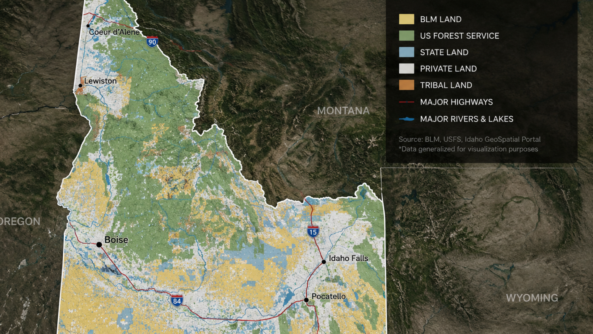
Federal land doesn’t generate local property tax revenue, so the federal government makes annual Payment in Lieu of Taxes (PILT) payments to the counties that contain it. In fiscal year 2026, Valley County is set to receive $1,769,492 in PILT funding for roughly 2,049,500 federal acres within its borders. Valley County’s total land area is 2,389,430 acres, which means about 86 percent of the county is on land that will never appear on a private property tax roll.
For brokers working with buyers near national forest land, this matters because the pool of privately held, taxable acreage in a county like Valley County is limited by geography, not by marketing.
What Does This Mean for Land Value and Client Conversations?
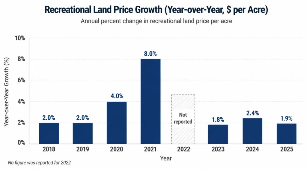
Recreational land, acreage bought mainly for hunting, riding, fishing, or seasonal getaways rather than as a primary residence, has held up well against a difficult broader land market. According to the National Association of REALTORS’ 2026 Land Market Report, produced with the REALTORS Land Institute, recreational land price growth averaged 1.9 percent in 2025, among the strongest categories alongside ranch and industrial land, even as national land values broadly stabilized around $7,200 per acre during a rate-tightening cycle.
That 2025 figure looks even more convincing next to the years around it. The same survey has tracked recreational land price growth annually since 2018, and it hasn’t posted a single year of decline in that stretch, including through the slowdown that followed the 2021 peak:
For brokers, the combination of limited private acreage near national forest land and steady recreational demand is the real value story, more durable than any single listing’s view or trail access. It’s also easier to defend to a client than a vague promise of endless potential, because it’s backed by numbers you can put in front of them.
What Should Be on a Broker's Due Diligence Checklist Near National Forest Land?
Before listing a property near national forest land, or writing an offer on one:
- Confirm there’s a current boundary survey, and get a copy before assuming where the property line falls.
- Ask the seller for any documentation of existing easements or historically used access routes. An undocumented “it’s always been used that way” isn’t the same as a legal right.
- Contact the local Forest Service ranger district directly if access across NFS land will be needed. Don’t rely on assumptions from the listing description.
- Check whether the county’s PILT and property tax records match the representation of the parcel’s boundaries and acreage.
- Set a realistic timeline with the buyer if any part of their plan depends on a Forest Service special-use authorization. Build that into the offer and financing conversation, not after closing.
Frequently Asked Questions
Does owning land next to national forest land automatically grant access to it?
No. Land next to national forest land follows the same public access rules as any other National Forest System land nearby. It doesn’t give the adjacent private owner any special right to build a road, run utilities, or develop across that land without a separate Forest Service authorization.
How long does it take to get access across national forest land approved?
There’s no fixed timeline because it depends on the scope of the request, the required environmental review, and the local ranger district’s workload. The process begins with a required pre-application meeting, then a full application, review, and often a public comment period, so buyers should plan for months, not days.
Can I hunt or hike on national forest land next to my property?
Generally yes, subject to Idaho Department of Fish and Game regulations and any local forest rules, the same as any other member of the public. That’s a separate question from building access or improvements across that land.
Why does so much of a county like Valley County show up as federal land?
Large stretches of central Idaho counties sit inside National Forest System boundaries. Valley County alone has roughly 2.05 million federal acres out of 2.39 million total, about 86 percent, according to the Department of the Interior’s Payment in Lieu of Taxes program.
Does every property near public land in Valley County border national forest specifically?
No, and this is worth checking before making any assumptions. Some Valley County parcels border land managed by the Bureau of Land Management (BLM) or the Idaho Department of Lands (IDL), a state endowment trust category with its own separate leasing and access rules, rather than the National Forest System. The Forest Service process described in this article applies specifically to land managed by the U.S. Forest Service. Brokers should confirm which agency actually manages the adjoining ground before advising a client, since the rules differ by agency. DF Development’s own communities, including Legacy Creek Ranch, border U.S. Forest Service land specifically, so the guidance above applies directly there.
Work With a Team That Knows National Forest Land in Idaho
DF Development has spent years working through exactly these questions. Legacy Creek Ranch, one of our current communities, sits directly along U.S. Forest Service land, and our team can walk brokers through what that boundary means for a given tract before a client ever writes an offer. For a broader grounding in how to position acreage like this to clients, our earlier post, 10 Things Every Broker and Realtor Should Know About Acreage for Sale in Idaho, is a useful companion to this one.
If you’re a broker or agent working with a client interested in national forest land or recreational acreage in Idaho, schedule a tour of our available properties. We’ll walk the ground with you and your client so everyone knows exactly what they’re buying, and what it takes to build on it.